

Agencies
New Delhi, January 01:

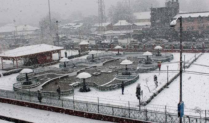
Director General of India Meteorological Department (IMD) Mrutyunjay Mohapatra on Saturday said that under the influence of an active western disturbance approaching north-west India, there could be rainfall or snowfall at most places over the western Himalayan region like Jammu and Kashmir, Ladakh, Himachal Pradesh and Uttarakhand between January 4 and 7.
“A western disturbance is impacting Jammu and Kashmir, Ladakh, region. Under its influence, we are expecting scattered rainfall or snowfall over the region in the next 48 hours. From January 4, an active western disturbance will approach northwest India. Under its influence from January 4-7, there could be rainfall or snowfall at most places over the western Himalayan region like J-K, Ladakh, Himachal Pradesh and Uttarakhand. It will cause light to moderate rain or thundershower over plains of northwest India including Rajasthan, Punjab, Haryana, Chandigarh, Delhi, west Uttar Pradesh, and Madhya Pradesh,” Mr Mohapatra said.
He further informed that this western disturbance will move eastwards and its intensity will decrease but rainfall activity will expand towards eastern India.
“As the western disturbance approaches north east India, the temperature rises. Therefore, the cold wave conditions that we are experiencing in some places over northwest India, will gradually abate. From January 4, the temperature in the planes of the country will be normal or above normal,” the senior IMD official said.
